Tel Code..: +229
Ethopian Airlines - THY -Air France- Royal Air Maroc
Viza..: Needs
Courses or boosters usually advised: Hepatitis A; Poliomyelitis; Tetanus; Typhoid; Yellow Fever.
Other vaccines to consider: Cholera; Diphtheria; Hepatitis B; Meningococcal Meningitis; Rabies.
Yellow fever vaccination certificate required for travellers over 1 year of age arriving from countries with risk of yellow fever transmission.
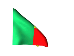
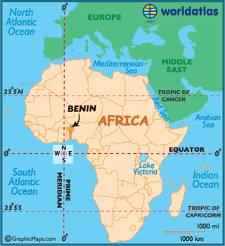
Name: Benin
Republic of Benin
President: Yayi Boni (2006)
Prime Minister: Vacant
Land area: 42,710 sq mi (110,619 sq km); total area: 43,483 sq mi (112,620 sq km)
Population (2012 est.): 9,598,787 (growth rate: 2.88%); birth rate: 37.55/1000; infant mortality rate: 60.03/1000; life expectancy: 60.26
Capital (2009 est.): Porto-Novo (official), 276,000;
Largest city and seat of government: Cotonou 815,000
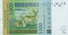
Monetary unit: CFA Franc
Read more: Benin:
Maps, History, Geography, Government, Culture, Facts, Guide & Travel/Holidays/Cities
| Infoplease.com http://www.infoplease.com/country/benin.html#ixzz38ZR8LC8X
The country we refer to as Benin today was once the powerful Kingdom of Dahomey.
It was eventually nicknamed the Slave Coast due to significant trafficking
through Dahomey of Africans (against
their will) to theAmericas,
specifically to the slave markets of Brazil and
the Caribbean.
 It was
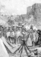
transformed into aFrench Colony
in the late 1800s, before finally gaining its full independence fromFrance in
1960. The country's current name (Benin) was adopted in 1975.
It was
transformed into aFrench Colony
in the late 1800s, before finally gaining its full independence fromFrance in
1960. The country's current name (Benin) was adopted in 1975.
In the twelve years following their independence, ethnic strife caused a period
of agitation, and subsequently, Benin witnessed a series of military coups, a
mistaken association with Marxism, and the somewhat typical health and
infrastructure problems indigenous to its neighbors, and most West
African countries.
Mathieu Kerekou overthrew the ruling triumvirate in 1972, and forced himself
into a presidential role, stating that Benin would not "burden itself by copying
foreign ideology, and wants neither Capitalism, Communism, nor Socialism."
Riots broke out in 1989 after the banking system collapsed, and Kerekou was
forced to arrange elections.
In the 1990's Benin became the first African country
to successfully transition from a dictatorship to a pluralistic political system,
and Prime Minister Nicephore Soglo secured a win in the presidential election,
remaining in office until Kerekou returned to power in 1996.
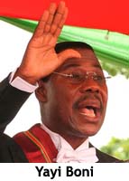 Yayi Boni assumed office
in 2006, following one of the first presidential elections considered to be free
and fair, and in 2011 was reelected to a second term - becoming the first
president to win without a subsequent runoff since 1991.
Yayi Boni assumed office
in 2006, following one of the first presidential elections considered to be free
and fair, and in 2011 was reelected to a second term - becoming the first
president to win without a subsequent runoff since 1991.
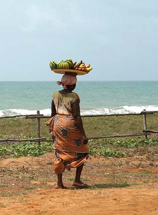
As a new democracy, the bright side is that Benin's economy is growing and
tourism is on the increase, especially along the coastal areas, and in the
wildlife national parks of the north.
Much of the interior population is still dependent on subsistence farming;
growing beans, corn and yams. Important cash crops include cotton, cocoa and
coffee.
Benin is one of Africa's smallest
countries, and displays little fluctuation in elevation.
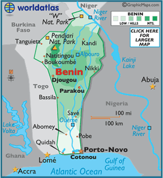
The country transitions from a narrow and somewhat sandy coastal area to a
marshy land with lagoons that rise into the La Terre de Barre Plateau.
The wooded savannah of the plateau continues on into the foot hills of the
Atakora Mountains of the northwest, a branch of the Togo Mountains.
Benin's highest point is Mt. Sokbaro, which rises 2,158 ft. (658 m); the lowest
point of the country is the Atlantic Ocean at 0 m.
From the mountainous northwest, the land slopes down into a broad plain and on
to the Niger River valley of the far northeast.
The Niger and Oueme are the country's major rivers.
Climate:
Benin is tropical, hot and humid in the south, and semiarid (quite dry) in north.
Overall, the dry season runs from November to April, and a rainy season from the
end of April through September.
The mean temperature is near 80 degrees (26°C).
Benin's economy is overwhelmingly agricultural, with most workers engaged in subsistence farming. The chief crops are cotton, corn, cassava, yams, beans, palm oil, peanuts, and cashews. Goats, sheep, and pigs are raised. There is a sizable freshwater fishing industry, and some ocean fish are also caught. Most of Benin's few manufactures are processed agricultural goods, basic consumer items, textiles, and building materials.
Petroleum, discovered offshore of Porto-Novo in 1968, and limestone are extracted. The country's other mineral resources, which include chromite, low-quality iron ore, ilmenite, and titanium, have not as yet been exploited. There is also a developing tourist industry. The country has limited rail and road systems, and they are almost exclusively in the southern and central parts of the country; rail lines are being extended to Niger. A hydroelectric plant completed in 1988 on the Mono River was a collaborative effort between Togo and Benin.
The chief imports are foodstuffs, capital goods, and petroleum products. The principal exports are cotton, cashews, shea butter, textiles, palm products, and seafood. The annual cost of imports usually exceeds earnings from exports. The leading trade partners are China, France, Thailand, Nigeria, and Indonesia.
Benin is governed under the constitution of 1990. The executive branch is headed by a president, who is both head of state and head of government. The president is popularly elected for a five-year term and is eligible for a second term. The unicameral legislature consists of the 83-seat National Assembly, whose members are popularly elected for four-year terms. Administratively, the country is divided into 12 departments.
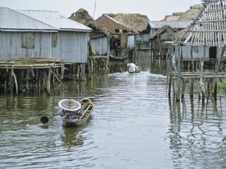
Benin falls into four main geographic regions. In the south is a narrow coastal zone (1–3 mi/1.6–4.8 km wide) fringed on the north by a series of interconnected lagoons and lakes with only two outlets to the sea (at Grand-Popo and Cotonou). Behind the coastal region is a generally flat area of fertile clay soils; this is crossed by the wide Lama marsh, through which flows the Ouémé River. In NW Benin is a region of forested mountains (the Atacora; highest point c.2,150 ft/655 m), from which the Mekrou and Pendjari rivers flow NE to the Niger River (which forms part of the country's northern border). In the northeast is a highland region covered mostly with savanna and containing little fertile soil.
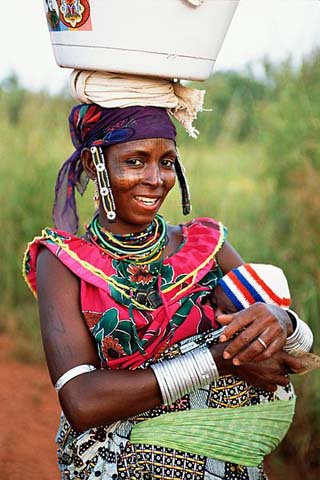
Although there are 42 ethnic groups in Benin, its population is divided into four main ethnolinguistic groups—Fon, Yoruba, Voltaic, and Fulani. The Fon-speakers, who live in the south, include the Fon, or Dahomey (Benin's largest single ethnic group), Aja, Peda, and Chabe subgroups. The Yoruba live in the southeast near Nigeria, the group's main homeland. The Voltaic-speakers live in central and N Benin and include the Bariba and Somba subgroups. The Fulani live in the north. French is the country's official language; Fon, Yoruba, and other indigenous tongues are also spoken. About a third of the inhabitants follow traditional religious beliefs; voodoo originated here some 350 years ago but was only officially recognized in 1996. About 43% are Christian (largely Roman Catholic) and 25% (living mostly in the north) are Muslim. Benin's population is concentrated in the southern portion of the country and in rural areas.